
A severe lack of local data and monitoring tools is hampering Ghana’s ability to manage its increasingly vulnerable coastline, researchers have warned at the 3rd Geophysics Academia Industry Meeting (G AIM).
The warning came from the team behind the TIDEKIT project, Protecting the Coast and Heritage of Keta Using Integrated Geophysical Methods, which is attempting to plug critical data gaps using low cost, field based technologies.

Dr. Cyril Dziedzorm Boateng, Principal Investigator of the project, said Ghana’s coastline remains exposed to hazards such as erosion, saltwater intrusion, and sea level rise, yet decisions are being made in a vacuum due to outdated or non existent local datasets.
“We lack real time, high resolution coastal data, which undermines both our understanding of the problem and our ability to respond,” Boateng told participants at the meeting which is under the theme: “Innovations in Coastal Resilience: Integrating Monitoring, Prediction, and Management for Africa’s Shorelines.”
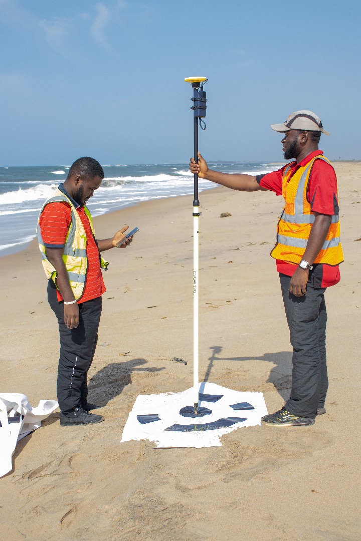
To help close this gap, the TIDEKIT team has deployed several tools: a web based tidal gauge to monitor sea levels, Electrical Resistivity Tomography (ERT) systems to track saltwater intrusion, drones to assess shoreline retreat, and three meteorological stations to gather climate data.However, the researchers stressed that these efforts remain small in scale and called for stronger institutional backing, long term funding, and improved infrastructure.

Dr. Selasi Yao Avornyo of the University of Ghana, the meeting’s keynote speaker, echoed the urgency. His research revealed that land subsidence, a significant but overlooked factor in coastal erosion, is rarely factored into vulnerability assessments in Ghana due to the lack of ground truth data.
Using calibrated remote sensing and field surveys, Dr. Avornyo’s team identified alarming subsidence rates of up to 9.16 mm per year around the Keta and Songor Lagoons. He described the Volta Delta as a “subsiding delta,” a classification that could fundamentally alter how Ghana plans for infrastructure and environmental management.
“Most models ignore vertical land motion, which distorts risk assessments and leads to poor planning,” he said.
As coastal hazards intensify with climate change, researchers say Ghana urgently needs a national framework for high quality, accessible coastal data. The TIDEKIT project is a step forward, but experts argue that only a coordinated, government supported approach including regional collaboration and open data policies will allow Ghana to design effective long term solutions.
“Without investment in local data infrastructure,” Dr. Boateng warned, “Ghana risks flying blind into the storms of climate change.”


